Looking for Wilderness to Explore?
Discover the best, most comprehensive resource for every federally managed wilderness area in the US
Ever wonder how many federally managed wilderness areas there are in the United States? Answer: 803 wilderness areas across 44 states and Puerto Rico.
Which states have the greatest number of federal wilderness areas? That would be California (154), Arizona (90), and Nevada (70).
Total wilderness acreage in the US? 111,706,287 acres total, or roughly 5% of total US land area.
Which states have the most acres of designated wilderness? Alaska dominates, with nearly 58 million acres, a bit more than half of all wilderness acreage in the US. California is second with just over 15 million acres, followed by Idaho at nearly 5 million acres.

Discover every federally managed wilderness area in the US
Want to learn more about any and every one of these 803 federal wilderness areas and see their exact locations and extent? Wilderness Connect has you covered, which is where all of the above information comes from.
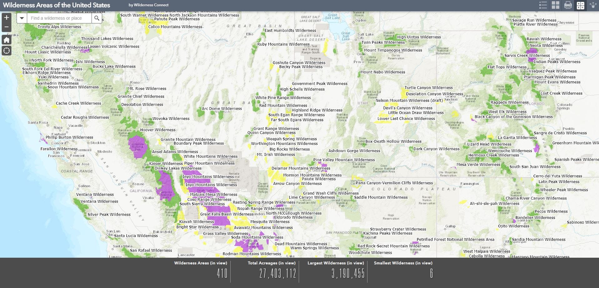
Just check out the screenshot below from their incredible, and incredibly comprehensive, interactive map of every federally managed wilderness area in the US. It is hands down the single-best, easiest-to-use, most comprehensive resource I have found for wilderness areas in the United States.
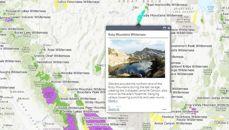
Zoom in and out, pan around, and click on any wilderness area to activate a pop-up window, like this one for Ruby Mountains Wilderness in northeastern Nevada:
Click on the “More” link in the popup and you’ll portal over to a dedicated web page specific to that wilderness, including a description, its acreage, when it was created, and which federal agency manages it. You’ll also find a standard set of link for each wilderness area, including maps, contacts, rules & regulations, wilderness laws, images, and volunteer organizations. (Of these, I’ve found the contacts information to be most useful—for example, it identifies the specific ranger district and contact information for US Forest Service wilderness areas).
And here’s the remarkable thing—this information is available for every single one of the 803 federally wilderness areas. Pretty impressive.
Exploring the wilderness database
I find the interactive map to be the easiest way to explore and learn about wilderness areas generally, you can also browse the Wilderness Connect database through its basic search function, which allows you to search and find wilderness areas by name or state.
There’s also an advanced wilderness search option, which allows you to sort results by state, managing agency, acreage, and year designated. You can even download the data as a CSV file if you want to really geek out on it.
Ready to experience them all? No problem, though you better get started soon.
Assuming you take three days on average to explore each wilderness area (which of course is nowhere near enough to really connect with a place), you’ll still need to block off 2,409 days to visit them all, or about six and a half years, not including of course the travel and logistics involved in getting to them all.
So given that such a pursuit would be 1) ridiculously time-consuming and 2) totally counter to my entire philosophy of wilderness experience (go deep, for as long as you can, to spiritually connect with the land as much as you can), I instead encourage you to use Wilderness Connect’s exceptional resources to find a wilderness area that really calls to you. (I for one have been particularly captivated by Nevada’s Jarbidge Wilderness, which has moved much higher on my wilderness life list after spending way too much time virtually touring dozens and dozens of intriguing wilderness areas.)
Who is Wilderness Connect anyway?
Other than the coolest place for all things US wilderness, here’s a bit more about the effort behind it all, from the ‘About Us’ content on their web site:
“Wilderness.net is a website formed in 1996 through a collaborative partnership between the W.A. Franke College of Forestry and Conservation's Wilderness Institute at The University of Montana, the Arthur Carhart National Wilderness Training Center and the Aldo Leopold Wilderness Research Institute. The latter two partners are the wilderness training and research arms of the Federal government, respectively.
The program's day-to-day activities are overseen by a working group and steering committee with additional oversight provided by the federal interagency National Wilderness Steering Committee and Wilderness Policy Council. The website educates hundreds of thousands of visitors annually about the benefits of wilderness and stewardship of wilderness under the Wilderness Act.”
I would like to close by just saying thank you on behalf of all wilderness lovers, adventurers, and supporters to everybody who helps makes Wilderness Connect possible. See you out there!


What a cool resource - thanks for sharing!